Showing posts with label climate. Show all posts

Friday, 18 January 2019

Industrial Smokestack Clouds Seriously Affecting our Climate

So you are driving down the highway, and you spot those refineries, factories, or power plants, constantly spewing enormous clouds into the air on a daily basis. Not affecting our climate, or are they? Ever wonder what happens to those aerosol plumes when the air pressure and temperature changes - you guessed it - instantaneous cloud formation. So much for those sunny bright blue skies - instead our sky is littered with a thick blanket of whitish gray cloud mass. It is quite surprising that there are so many studies lacking in this area - how factory and power plant aerosols affect our climate and precipitation patterns. 

Take a look at some of these photos, and it instantly becomes obvious. If you are ever in Edmonton driving on the east side of Anthony-Henday, before passing by the Suncor and Enbridge sites, switch your air intake (to circulate internally) and after some time, switch to external air intake and you will notice the difference in smell. These aerosols are loaded with nasty pollutants and chemicals and make you wonder what the lung cancer rates are like for some people living close to these areas long-term. 

In this photo, you can spot the factory aerosols being released into the sky (far right), as they drift far left into a plume, while the lighter aerosols drift higher up forming those anomalous clouds

And the weather channel would have you believe that these clouds are formed naturally? From a distance, these are clouds formed from the Suncor and Enbridge facilities and refinery plants.

Got clouds? What would have been a beautiful sunny day is now shrouded in clouds, especially if you live in the north east. Driving to the south of these clouds, we noticed that the sun was visible.

We had our videographer shoot this small footage, while the driver passes by the Enbridge and Suncor sites.

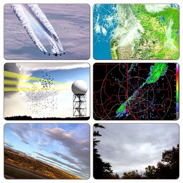
Just imagine how many clouds are formed on a daily basis and then sent along the drifts of wind, where they accumulate and snow or rain down on nearby cities (as shown in radar - ground-based precipitation.)

Just some more aerosol madness blocking out the sun in these areas.


The massive aerosols spewing out from a distance.

This day, in a neighborhood that was north east, you could see the massive amounts of clouds being formed overhead, which later trickled down some snow in the area.


Tuesday, 30 June 2015

Anticyclone Hovers Over Utah NEXRAD Tower For 2 Days!

A high pressure zone appears just south west of Utah, moves its way   towards Cedar City, UT (KICX Nexrad tower), and then heads north towards Salt Lake City, UT (KMTX Nexrad tower). The high pressure zone hovers over the KMTX NEXRAD tower for more than 2 days, creating an anticyclone weather system and influencing the jet stream! It looks KMTX has a new friend...


It looks like Salt Lake City's KMTX NEXRAD Tower has a new friend...

Related Information:

Certain types of radar, especially C-Band radar, can weaken or strengthen a tornado. But this can also depend on atmospheric conditions, radar emission strength, cyclone strength, etc. 

I do believe that much of the recent tornadoes in the past have been artificially created, in an attempt to use weather weapons by military in the near future. They are testing out this type of technology. DutchSinse has done some great documentation and studies regarding these man-made tornadoes:


Also, there is a document entitled, Weather as a Force Multiplier Owning the Weather in 2025, which discusses the military use of weather:

Sunday, 17 November 2013

The Telegraph: Weather Could be Controlled Using Lasers i.e. Electromagnetic Waves

The Telegraph put out an article stating that, "Scientists are attempting to control the weather by using lasers to create clouds, induce rain and even trigger lightning." It further states:
Experts from around the world are to gather at the World Meteorological Organisation next month to discuss how powerful laser pulses can be used to generate changes in the atmosphere that influence the weather. . . Their experiments have shown that intense pulses of light can cause ice to form and water to condense, leading to the formation of clouds.
However, we believe that lasers, or specific bands of electromagnetic frequencies, have already been in use for quite some time now, and have been affecting our weather on a daily basis. This is perhaps the reason why we are seeing NEXRAD / Doppler radar, causing strange weather anomalies, affecting our weather drastically. The question we must ask ourselves is, should we trust in whose hands this technology lies? More importantly, what are the long-term environmental effects of electromagnetic weather-modification, and its negative implications? How will this change natural weather cycles and formations, and what consequences will it have? And for the bird-watchers, do we really want more dead birds falling from the sky, as a result of increased electromagnetic (i.e. laser) emissions in the atmosphere? Also, should we deem this to be beneficial for our honey-making bees and their colony collapse? Should we really be zapping our skies, all in the name of corporate-corrupted science and weather-perverts? Aren't are skies already enough polluted with EMF emissions? Do we really need more artificial electromagnetic radiation that is clearly not good for human health?


Pencil Beams of Directed-Energy from NEXRAD Sites Creating Artificial Cloud Cover?

Around the time of 23:00 UTC (Nov 12/13), pencil beams of directed energy were sent out of NEXRAD sites throughout the central-eastern States. Immediately after this time, on satellite imagery, we see a vast artificial cloud cover being generated over those areas. We believe these may be ionized clouds resulting from the directed energy of pencil beams emitted from the NEXRAD sites working in unison. See the full playlist of events here.


Wednesday, 9 October 2013

Sprayed Aerosols Over Western Continent

Oct 9/13 - The climate engineers have been at useless work the past few days. Sprayed aerosols were spotted in Calgary, AB. Towards the evening, the linear mat of collected aerosols can clearly be seen towards the West, oriented SW-NE. They can also be seen on satellite images, sucking up moisture, specifically going through NEXRAD-active regions. The NEXRAD sites are shown as dots in the two last images, and moisture can be seen channelling through these areas.


The above photographs were taken in Calgary, AB


Atlantic Storm Being Climate Engineered with Aerosols & NEXRAD

Oct 9/13, 16:00 UTC - Check out where the tail of this tapered storm in the Atlantic is being fed from. We suspect storm-enhancing aerosol chemical agents being sprayed, along with NEXRAD electromagnetic re-directing of the moisture-collected aerosols. Also, take a look at this video, depicting NEXRAD Station KFFC in Atlanta, GA intensifying the nearby storm system using direct beams of microwave energy.

24 Hour Water Vapour Loop Animation

Animation Playback Using IR Satellite


The aerosol spraying near the Atlantic on Oct 8/13


NEXRAD Image: Morehead City, NC - Take note of the tapering arm that is feeding a portion of  this storm

Sunday, 6 October 2013

Weather News & Radar Anomalies for Sept - Oct, 2013

Provided below are images for recent radar anomalies and weather news reports during September and early October, 2013. All images and posts are taken from this page.

Are transmitter / receiver devices influencing our weather? Intellicast seems to suggest this, as we can see a region of #rain / moisture hovering over a large area where the Globalstar Gateway devices are located. This is West of #HighRiver, #Alberta.
Sept 18/13 - Can you match together the pieces of the radar puzzle on the satellite image? Clearly we can see a correlation between the shaping of our weather systems and radar circumference, can we not?
Sept 18/13 - If you could see clouds forming around the NEXRAD radar circumference as seen with these satellite and radar images, what could you infer? How do water molecules in the air react to electromagnetic forces emitted from these radar stations ? Has this phenomenon been studied yet by scientists, or is it over-looked and forgotten?
A roll cloud generated with the help of electromagnetic forces. Must we say anymore? Check out Dutchsinse on Facebook, YouTube, or Google his website.
Sept 21/13 - Watch what appears to be a cloud roll driven directly through the centre of the Spokane, WA (NEXRAD) meteorological station. These moisture-containing clouds align perfectly with the centre of the radar circumference. Is NEXRAD doing rails?

Sept 21/13 - how to leave the pulsed aerosol skies behind. Open up Intellicast. Find the "sky pockets" near your area and note the wind orientation. Travel in that direction towards clear skies. Enjoy the sunshine. The red arrow shows the direction (West) we travelled to reach the sunny side, and the last picture shows us looking back East to see the white mass of aerosol-covered skies where we formerly were.
Sept 22/13 - Another #tornado over the Kirtland Air Force Base in #Albuquerque, #NewMexico. Coincidence? Check out Dutchsinse on Facebook
Sept 24/13 - Climate Engineering in a nutshell: Spray metallic aerosols inland and over ocean while a tropospheric river is advancing towards land. These metallic particles rob water vapour from the air to form "clouds", thus diminishing cumulus clouds' to form. These metallic-laced clouds can then be shaped and directed with electromagnetic wave frequency i.e.NEXRAD radar stations, like the one shown centred in the 4th frame. With all NEXRAD / Doppler devices working in unison, an enormous "cloud front" can be created. Many of today's weather patents were designed for military industrialization and so-called "defence" purposes, regarding satellite communications, weaponized weather, and much more.
Sept 28/13 - Covering vast parts of the #sky and blocking our #natural #sunlight as this aerosol-laced #weather front moves in from the West. Clearly, spraying planes were seen in #Alberta and Western states (#Nevada, #Washington, #Oregon, etc). #Calgary #skies were filled with #doppler signatures of #electromagnetic #frequency left in the #metallic-laced #clouds. May #Creator destroy the #sky perverters and restore our #weather in due time.


Sept 27-28/13 - #NEXRAD-active regions bringing in metallic #aerosol-laced #weather fronts where they don't belong. Also known as "#cloud forcing", this is depleting one area of #moisture for another. Perhaps what we experience as "global #warming" bizarre weather patterns is a direct or indirect result of tampering with #Mother #Nature using weather-patented #aerosols and #electromagnetic frequency, such as #HAARP, #ionization, transmitter antennas (Doppler), cellphone towers, HV power lines that create corona ions and affect our weather in ways that have yet to be more closely studied. The massive weather front seen in satellite image was reported as being half the size of #US
Sept 28/13 - Could this be a trail of aerosols left behind an advancing weather front, stretching nearly the size of half the U.S. in length?
Sept 28/13 - Sometimes, a picture says a thousand words...
Sept 29/13 - Ask a meteorologist this: why is the heaviest amount of precipitation occurring around these active NEXRAD stations ?
Sept 29/13 - As a tropospheric front approaches from the West coast, we can see NEXRAD Doppler (radar) leaving its marks in the clouds. It's not rocket science however--something that is emitting up to 700,000 watts of microwaves acting upon matter (sky & clouds), will those particles of matter not respond and be affected ? Welcome to NEXRAD weather manipulation
 Sept 29/13 - Why do moisture / clouds, or perhaps metallic aerosol-laced clouds seen to be passing directly through the centre of Eureka, CA NEXRAD (Doppler) radar, leaving behind "doppler" signatures in the clouds?
Sept 30/13 - Watch this low pressure weather system develop directly around the centre of the radar circumference at the Radisson, SK Doppler station.
Oct 2/13 - Check out the tapering linear weather front making its way into California, Nevada, and Idaho. The radar doesn't show this "cloud" formation as containing any moisture (ie. Nevada), and the tapering cloud simply does not show up on the radar. With supporting photographs from SkyWatchers in Cali, Nevada, etc. should we presume that these "clouds" appearing on satellite are simply sprayed chemical agents that haven't collected any moisture as of yet.
Oct 5/13 - Usually after the atmosphere is sprayed with metallic particles, one can see signs of an electromagnetic-carved sky. As this weather front approaches from the West, we can see it being pulsed by Doppler and other EM waves, as it comes in "waves". You may notice the faint circles in some areas where the Doppler sites are located. More importantly, take note of the Rockies region being clear, as this is where the Doppler's electromagnetic signal begins to diminish from both AB and BC side.
Oct 6/13, 5.00 UTC - Take a look at this weather front in the Eastern states, and see where the moisture is precisely being channeled and driven. In each radar image, there lies a powerful Doppler facility at the centre.
Oct 6/13 - What was described by the media as an unusually strong storm, brought hail and rain to South Dakota, generating 9 tornadoes throughout Iowa and Nebraska, and leaving 25,000 residents without power. Friday's snowfall in some areas surpassed the entire snowfall of October, in 1919, breaking records during that time. Black Hills received over 43 inches of snow by Friday night. Although it is interesting that the media mentioned "Rapid City", they failed to tell us what else lies in Rapid City. Perhaps there was some people paying attention to the Rapid City NEXRAD facility, where clouds circled around the radar for over 10 hours. However, we believe that the moisture which brought clouds was fed from NEXRAD stations south of SD. We will upload animation for this shortly on weatherpeace.blogspot.ca
Oct 6/13 - Perhaps our weather forecasters should take a closer look at where these low pressure zones are being formed. The one on the left is at Sioux Falls, SD, and the second is at La Crosse, WI, which is precisely where the actively pulsing NEXRAD stations are located.


Related Articles:

Infrasound Pulsations Generate Quakes and Tornadoes in the Midwest US
Weather News & Radar Anomalies for Sept - Oct, 2013