24 Hour Water Vapour Loop Animation
Animation Playback Using IR Satellite

 |
| The aerosol spraying near the Atlantic on Oct 8/13 |


 |
| NEXRAD Image: Morehead City, NC - Take note of the tapering arm that is feeding a portion of this storm |
|
| The aerosol spraying near the Atlantic on Oct 8/13 |
|
| NEXRAD Image: Morehead City, NC - Take note of the tapering arm that is feeding a portion of this storm |
Provided below are images for recent radar anomalies and weather news reports during September and early October, 2013. All images and posts are taken from this page.
 |
| Are transmitter / receiver devices influencing our weather? Intellicast seems to suggest this, as we can see a region of #rain / moisture hovering over a large area where the Globalstar Gateway devices are located. This is West of #HighRiver, #Alberta. |
 |
| Sept 18/13 - Can you match together the pieces of the radar puzzle on the satellite image? Clearly we can see a correlation between the shaping of our weather systems and radar circumference, can we not? |
 |
| Sept 18/13 - If you could see clouds forming around the NEXRAD radar circumference as seen with these satellite and radar images, what could you infer? How do water molecules in the air react to electromagnetic forces emitted from these radar stations ? Has this phenomenon been studied yet by scientists, or is it over-looked and forgotten? |
 |
| A roll cloud generated with the help of electromagnetic forces. Must we say anymore? Check out Dutchsinse on Facebook, YouTube, or Google his website. |
 |
| Sept 21/13 - Watch what appears to be a cloud roll driven directly through the centre of the Spokane, WA (NEXRAD) meteorological station. These moisture-containing clouds align perfectly with the centre of the radar circumference. Is NEXRAD doing rails? |
 |
| Sept 21/13 - how to leave the pulsed aerosol skies behind. Open up Intellicast. Find the "sky pockets" near your area and note the wind orientation. Travel in that direction towards clear skies. Enjoy the sunshine. The red arrow shows the direction (West) we travelled to reach the sunny side, and the last picture shows us looking back East to see the white mass of aerosol-covered skies where we formerly were. |
 |
| Sept 22/13 - Another #tornado over the Kirtland Air Force Base in #Albuquerque, #NewMexico. Coincidence? Check out Dutchsinse on Facebook |
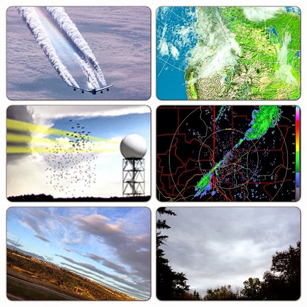 |
| Sept 24/13 - Climate Engineering in a nutshell: Spray metallic aerosols inland and over ocean while a tropospheric river is advancing towards land. These metallic particles rob water vapour from the air to form "clouds", thus diminishing cumulus clouds' to form. These metallic-laced clouds can then be shaped and directed with electromagnetic wave frequency i.e.NEXRAD radar stations, like the one shown centred in the 4th frame. With all NEXRAD / Doppler devices working in unison, an enormous "cloud front" can be created. Many of today's weather patents were designed for military industrialization and so-called "defence" purposes, regarding satellite communications, weaponized weather, and much more. |
 |
| Sept 28/13 - Covering vast parts of the #sky and blocking our #natural #sunlight as this aerosol-laced #weather front moves in from the West. Clearly, spraying planes were seen in #Alberta and Western states (#Nevada, #Washington, #Oregon, etc). #Calgary #skies were filled with #doppler signatures of #electromagnetic #frequency left in the #metallic-laced #clouds. May #Creator destroy the #sky perverters and restore our #weather in due time. |

 |
| Sept 27-28/13 - #NEXRAD-active regions bringing in metallic #aerosol-laced #weather fronts where they don't belong. Also known as "#cloud forcing", this is depleting one area of #moisture for another. Perhaps what we experience as "global #warming" bizarre weather patterns is a direct or indirect result of tampering with #Mother #Nature using weather-patented #aerosols and #electromagnetic frequency, such as #HAARP, #ionization, transmitter antennas (Doppler), cellphone towers, HV power lines that create corona ions and affect our weather in ways that have yet to be more closely studied. The massive weather front seen in satellite image was reported as being half the size of #US |
 |
| Sept 28/13 - Could this be a trail of aerosols left behind an advancing weather front, stretching nearly the size of half the U.S. in length? |
 |
| Sept 28/13 - Sometimes, a picture says a thousand words... |
 |
| Sept 29/13 - Ask a meteorologist this: why is the heaviest amount of precipitation occurring around these active NEXRAD stations ? |
 |
| Sept 29/13 - As a tropospheric front approaches from the West coast, we can see NEXRAD Doppler (radar) leaving its marks in the clouds. It's not rocket science however--something that is emitting up to 700,000 watts of microwaves acting upon matter (sky & clouds), will those particles of matter not respond and be affected ? Welcome to NEXRAD weather manipulation |
 |
| Sept 29/13 - Why do moisture / clouds, or perhaps metallic aerosol-laced clouds seen to be passing directly through the centre of Eureka, CA NEXRAD (Doppler) radar, leaving behind "doppler" signatures in the clouds? |
 |
| Sept 30/13 - Watch this low pressure weather system develop directly around the centre of the radar circumference at the Radisson, SK Doppler station. |
 |
| Oct 2/13 - Check out the tapering linear weather front making its way into California, Nevada, and Idaho. The radar doesn't show this "cloud" formation as containing any moisture (ie. Nevada), and the tapering cloud simply does not show up on the radar. With supporting photographs from SkyWatchers in Cali, Nevada, etc. should we presume that these "clouds" appearing on satellite are simply sprayed chemical agents that haven't collected any moisture as of yet. |
 |
| Oct 5/13 - Usually after the atmosphere is sprayed with metallic particles, one can see signs of an electromagnetic-carved sky. As this weather front approaches from the West, we can see it being pulsed by Doppler and other EM waves, as it comes in "waves". You may notice the faint circles in some areas where the Doppler sites are located. More importantly, take note of the Rockies region being clear, as this is where the Doppler's electromagnetic signal begins to diminish from both AB and BC side. |
 |
| Oct 6/13, 5.00 UTC - Take a look at this weather front in the Eastern states, and see where the moisture is precisely being channeled and driven. In each radar image, there lies a powerful Doppler facility at the centre. |
 |
| Oct 6/13 - What was described by the media as an unusually strong storm, brought hail and rain to South Dakota, generating 9 tornadoes throughout Iowa and Nebraska, and leaving 25,000 residents without power. Friday's snowfall in some areas surpassed the entire snowfall of October, in 1919, breaking records during that time. Black Hills received over 43 inches of snow by Friday night. Although it is interesting that the media mentioned "Rapid City", they failed to tell us what else lies in Rapid City. Perhaps there was some people paying attention to the Rapid City NEXRAD facility, where clouds circled around the radar for over 10 hours. However, we believe that the moisture which brought clouds was fed from NEXRAD stations south of SD. We will upload animation for this shortly on weatherpeace.blogspot.ca |
 |
| Oct 6/13 - Perhaps our weather forecasters should take a closer look at where these low pressure zones are being formed. The one on the left is at Sioux Falls, SD, and the second is at La Crosse, WI, which is precisely where the actively pulsing NEXRAD stations are located. |

 |
| Moisture aligning with the NEXRAD facility at Laughlin AFB, TX. Time: 20131006.0516 |
 |
| Oct 6/13, 5.00 UTC - Take a look at this weather front in the Eastern states, and see where the moisture is precisely being channelled and driven. In each radar image, there lies a powerful Doppler facility at the centre. |
 |


