Update:
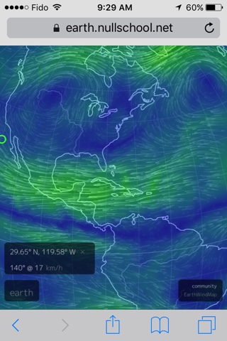
After analyzing current jetstream models, Irma should have simply kept going west unless it was steered elsewhere by using EMF weather modification means. This storm should have gone right into the Gulf of Mexico.
Notice the long line of moisture tapering off this storm system, stretching from Florida all the way up the coast, past Newfound Land. This long line of moisture seems to connect to a cyclone near Iceland. Strange, isn't it? There could be some geoengineering involved here.
Hurricane Irma has just swept through the Dominican and Cuba. Most people are speculating that it may hit Florida, and some even suggesting it may head north towards North Carolina and New York.
However, after analyzing current jetstream models, it appears as though it may simply kept going west, as there are some strong northerly air currents that may prevent it from going north, unless it is steered elsewhere by using EMF weather modification means.
It is possible that this storm may go right into the Gulf of Mexico, and if it still retains its strength, hit Mexico. If driven slightly north, it could hit Texas again.
 |
| The northern winds sweeping over Florida peninsula should have prevented this cyclone from moving north. |
Notice the long line of moisture tapering off this storm system, stretching from Florida all the way up the coast, past Newfound Land. This long line of moisture seems to connect to a cyclone near Iceland. Strange, isn't it? There could be some geoengineering involved here.


